Ireland Map Presentation Template for PowerPoint & Google Slides


Product Description
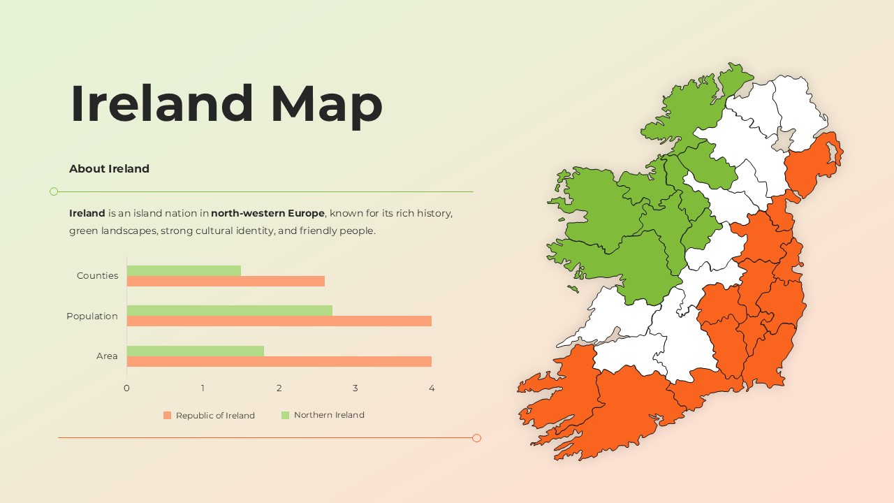
Editable Ireland Map Template
This presentation focuses on a clear, visual overview of Ireland through a modern regional map layout. It is a fully editable presentation template designed for geographic, educational, and analytical use. The slides are compatible with both PowerPoint and Google Slides for seamless editing. The template is ideal for presenting regional distinctions, comparisons, and high level insights across Ireland. This Ireland map presentation template helps users communicate geographic structure and regional differences with clarity and visual balance. The design highlights counties and regions using color coding, supported by simple data visuals that enhance understanding without overwhelming the audience. It is suitable for professional, academic, and informational presentations where location context matters.
What’s Inside the Ireland Map Template
The template includes a detailed map of Ireland with clearly defined regional boundaries and contrasting color segments. Supporting content areas allow space for descriptive text, regional summaries, and contextual explanations. A compact comparison chart is integrated to visually contrast key metrics such as population, area, or administrative divisions. The layout balances text and visuals, ensuring the map remains the focal point while still allowing meaningful data presentation.
Key Features of Ireland Map Template
- Fully editable Ireland map with regional color segmentation
- Clean layout designed for geographic clarity
- Integrated bar style comparison chart
- Text placeholders for regional descriptions and insights
- Professional color palette suitable for formal presentations
- Easy customization in PowerPoint and Google Slides
Ideal For
This template is ideal for educators explaining Irish geography, students preparing academic presentations, and professionals creating regional overviews or country profiles. It also works well for tourism presentations, policy briefings, cultural overviews, and introductory country analysis where a clear visual map is essential.
Slide Highlights
The main slide features a large, high resolution Ireland map that draws immediate attention. Regional color separation makes it easy to distinguish areas at a glance, while the supporting chart adds quantitative context. The left aligned text section provides room for background information or key talking points, making the slide suitable for both live presentations and shared documents.
Compatibility & Formats
The template is fully compatible with Microsoft PowerPoint and Google Slides. All elements, including maps, charts, text, and colors, are fully editable. No additional fonts or plugins are required, ensuring smooth use across devices and platforms.
Login to download this file
What do you think of this template?
Category:
Infographics
Aspect Ratio: 16:9
Item ID: SPT0362
Color
Related Templates
-
-
-
-
-
-
-
-
Portugal Map Template for PowerPoint & Google Slides
Infographics
-
-
-
-


